DLTK's Blog
Ha Ling Peak Trail Guide in Kananskis
August 2021
As summer starts to wane and while the weather stays hot, I’ve been doing a lot of early morning hikes. Since I am visiting friends and family in Calgary, Alberta this year, morning hikes with them are a great way to beat the heat and the crowds of Kananaskis in the summer! My sister and I went to Middle Lake with her partner and their dog; my best friend and I tried our [legs] at the shorter + easier hike Grassi Lake trail; and a couple friends and I recently hiked the very well-known summit Ha Ling Peak together! I have been getting my steps in, to say the least.
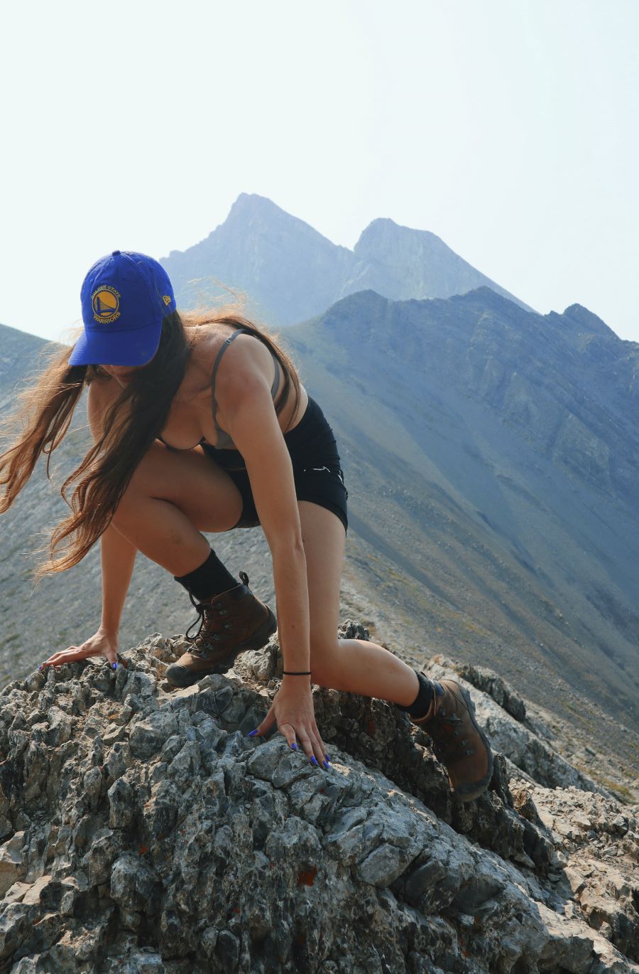
While a hike like Ha Ling Peak is short, it is difficult for first-time or less-regular hikers. So, be warned! I really, really enjoyed myself on the stunning 7.2 km (4.5 mile) roundtrip. I hike quite a bit, and while I would say this was a “difficult” hike, it is not as hard as something like Tent Ridge, for example, and I certainly could have gone at a faster pace or for more kilometers. Well-versed + properly trained hikers will not find Ha Ling Peak too difficult at all. Even the well-known Sulphur Mountain trail (with its incline stretch being longer) is probably a more tedious and frustrating hike than Ha Ling Peak, too.
If you are planning to give Ha Ling Peak a try, you might want to check out AllTrails for reviews, or read below for a short synopsis of the hike! Parking in Kananaskis requires a Conservation Pass starting this year (2021).
The Kananaskis Conservation Pass is $15.00 CAD for one day or $90.00 CAD for the season. You can purchase the ticket online using a credit card, your name, and license plate, but make sure you’re in an area with cellular/data service when you do so! The Ha Ling Peak area does not have service in the parking lot (but it has service once you summit the mountain!), so you will want to plan or pay at the top. The parking lot gets busy and fills up quickly: Ha Ling Peak is by far the most summited mountain in the Banff/Canmore/Kananaskis area. Even with our 6 am start-time, we weren’t even close to being alone when climbing up the mountain or starting our trek. Lots of folks like to trail-run this stretch of Canmore’s trails since it has a serious incline, many sets of stairs, and low kilometers. We saw some early-bird trail-runners coming DOWN the mountain as we were going up it: talk about dedication!!
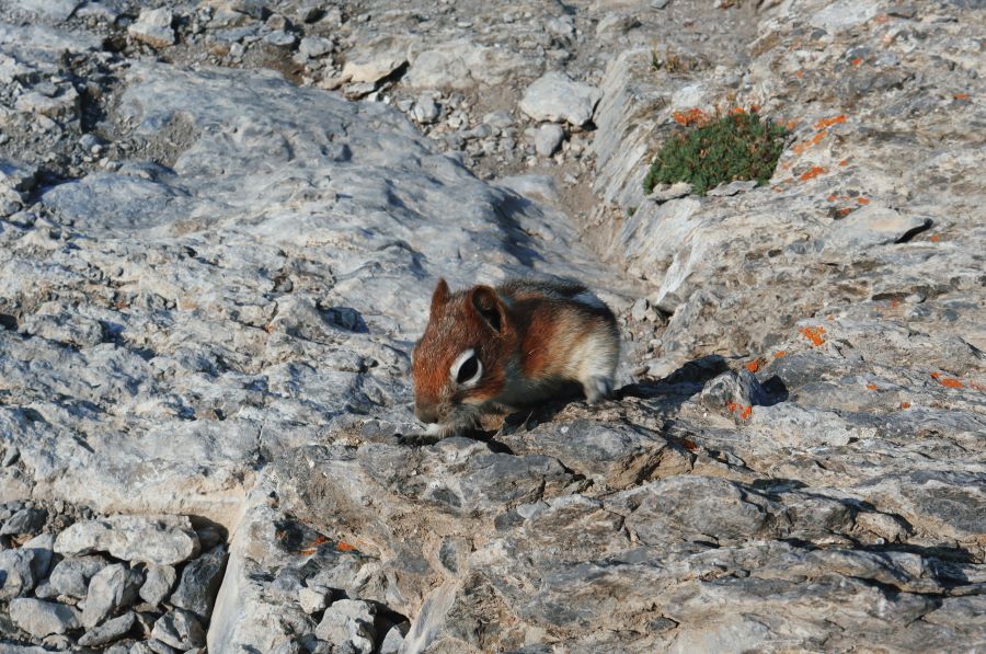
The hike starts off at a steady incline and stays that way for the entire 3.5 km way up (there is an elevation gain of 748 m if you decide to try the final scramble to the peak). About 1 km into the hike, you will find yourself at the first switchback and a rock bench, where you can take a short break. We saw big horned sheep grazing in the forest beneath the trail on this stretch, and it looked like there was a momma and two babies grazing flora! Moreover, we saw lots of wildlife on this hike, including some very cute chipmunks. But be warned: please do not feed the chipmunks!!!
Now, just a tip: I would NOT recommend that you take more than two minutes to break anywhere other than at the peak, since you will want to keep your muscles warm and your lactic acid/adrenaline flowing to help push you up further. I would say this is advice most hikers already know about, but again, if you are less experienced, use this Ha Ling Peak trail as a learning opportunity to test out your cardio and endurance!
Only a few hundred meters after “bench rock,” there is a great lookout spot where you might want to take a couple pictures. Around this lookout, there are some helpful updates to the trail, with metal/chain railings to help hikers ascend flattened rock areas. And it appears as though Parks Canada has even chipped away some foot holds for folks looking for more stability as they hike. I do know that there are mixed feelings about the trail updates that have occurred here over the past couple years, but I found everything extremely helpful and genuinely could not imagine trying to hike this with your family (yes, there were TONS of kids on this trail) without many of these rails, footholds, stairs, etc.
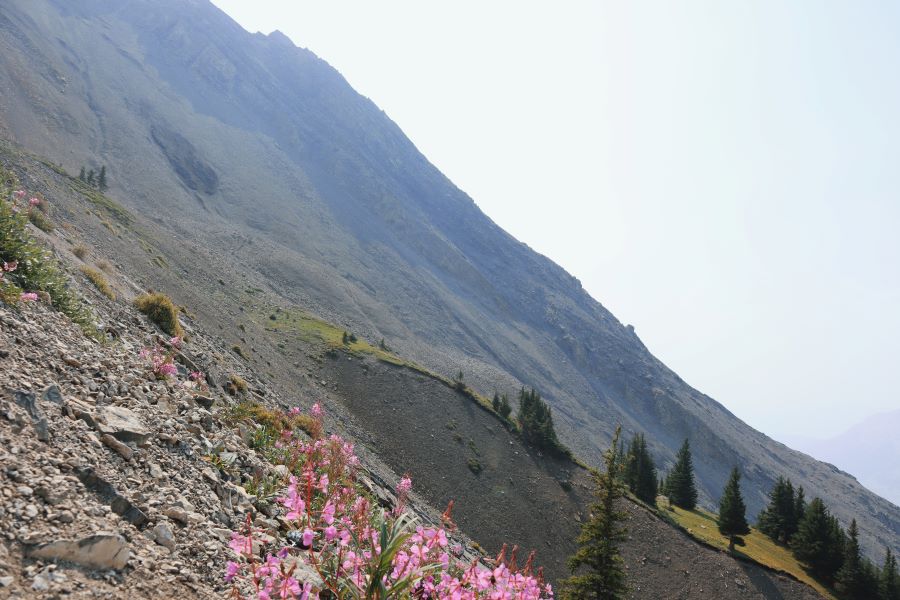
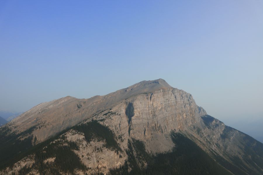
After this lookout, you will quickly approach another switchback and then you will hike another km until you get to the most beautiful lookout of all—of course, other than Ha Ling Peak’s saddle and summit—for more viewing pleasure and photos of Mount Rundle! This lookout also acts as a switchback and is protected by more chain railing to help hikers from straying too far off course. Here, there are some stunning lake and mountain vistas!
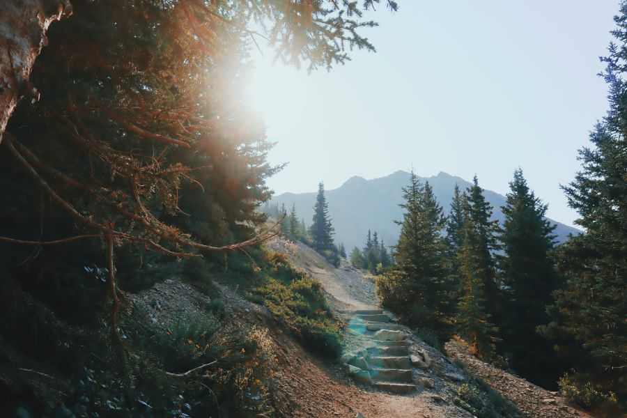
Once you hit this third and (sort of) final switchback, you will know you are on the final half of the ascent. Yay! Here is where the stairs come in… You will probably end up hiking almost a km and a half of stairs and severe incline. Now, there are two types of stairs on this hike, and you can use these as markers and for motivation. There are a TON of rock stairs along the trail to help hikers make their way up. This rock-stair portion of the hike will feel especially grueling and daunting, but please don’t be deterred. Like doing any physical activity that requires cardio and endurance, it’s all about your headspace and playing the mind-game. Once you finally see the wooden stairs, then you will know you are *especially* close to the saddle of Ha Ling Peak. You will find three sets of wooden stairs (with some rock stairs and inclined trail in between), and beyond that final set of wooden stairs, you will be able to get a wonderful view of the saddle and the peak! Again, YAY!!
Once here, feel free to hike only the last few hundred meters to the saddle or do continue your way up to the peak. The final ascent of Ha Ling Peak is what is known as a “scramble.” There is only ONE scramble on this hike, making it easier than a lot of difficult-rated hikes in the Kananaskis area. My biggest recommendation for scrambling, though, is, if you choose to try out Ha Ling Peak, DO NOT even attempt the scramble if you are not prepared or trained to do so. A scramble is essentially a type of hiking/mountain climbing wherein there is no maintained trail, a serious incline, and no specific path to take to get to the destination. For Ha Ling Peak, the scramble consists of a very steep and rocky final portion of the hike (this is how you’ll reach the official summit); hikers must carefully place their feet (and sometimes their hands) in stable parts of the rocky, dusty ground to ascend further up. Note: this is a very dangerous type of mountain climbing and has resulted in serious injury or worse for even seasoned hikers in Canmore, Alberta. Please check out our "what to bring on a day hike"-style blog posts for more info on how to responsibly pack in and out and how to prepare for more strenuous hikes:
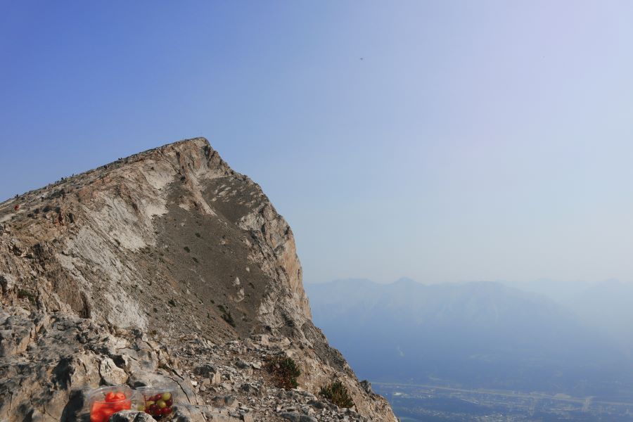
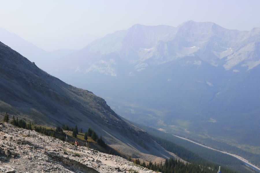
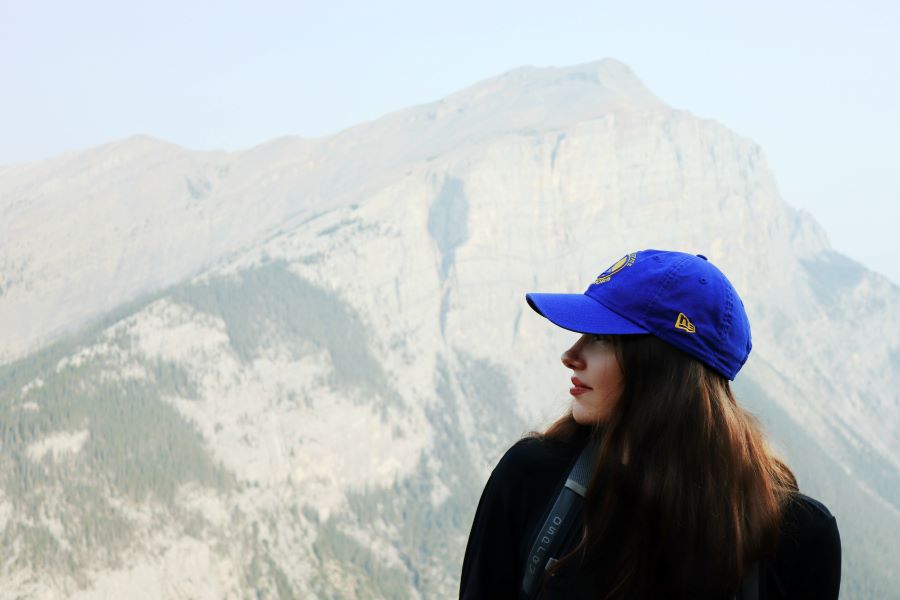
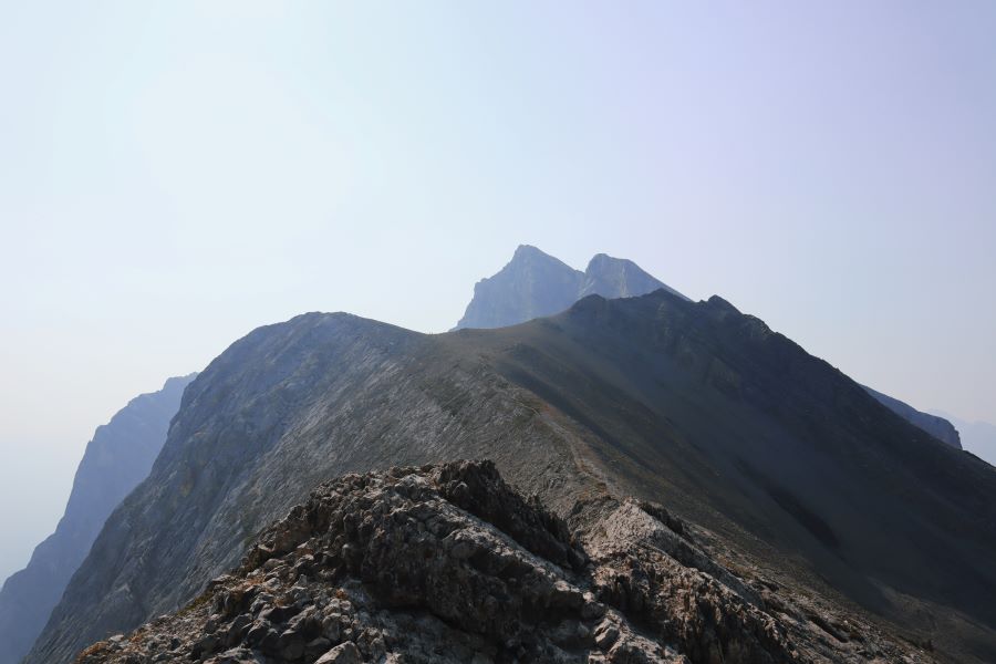
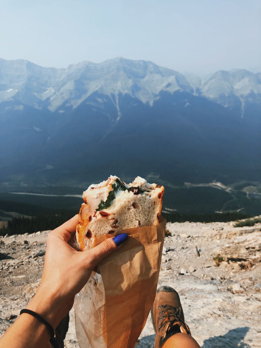
Luckily, the saddle of Ha Ling Peak offers SERIOUSLY beautiful views as well, and you do not NEED to attempt the scramble to the top. Pictured above is a view of the summit and many hikers scrambling to the top, seen from the saddle of Ha Ling Peak. And below is a picture of the less popular Miner's Peak, easily seen from the saddle, too. There are plenty of spots up on the ridge of the saddle to eat your lunch or snacks and take in all the views and to get STELLAR photos. On average, it takes folks between 3-5 hours to complete this hike. It took us 2 hours to get up, we stayed for an hour at the top, and 1.5 hours to get down (for a total of 3.5 hours of actual hiking or 4.5 hours for a roundtrip total, including breaks).
As Ha Ling Peak is an “out-and-back” hike, the descent follows the exact same route as the ascent. And while it is certainly faster to hike down the mountain than it is to hike up it, be forewarned, you will be working different muscles on the way down, and you might find hiking down the trail to be very hard on your knees. Hiking poles are a great idea for Ha Ling Peak’s descent. As if I need to say this: please, *please* wear proper hiking boots!
We got back to our car well before lunchtime and were SO happy to have brought extra sandals to change our sore feet into. Wow! What a beautiful and memorable experience to cross off my list. Next up on my Kananaskis hiking bucket list: Sarrail Ridge via Rawson Lake Trail!
Thanks so much for following along on my adventures; I sincerely hope this trail review was helpful; and happy hiking! We have lots of DLTK's summer activities, and be sure to check out one of our other hiking posts:
- Grassi Lake Trail Guide
- Tombstone Lakes in Kananaskis Country
- Bruce Trail: Peninsula National Park
- Bruce Trail: Chedoke Radial Trail
- Hiking Grotto Canyon
- Hiking the Kicking Horse to Amiskwi Trail
- Hiking the Loop Brook Trail
- Peyto Lake Trail
- A Rainy Day in the Mountains
 About Tasha:
I am the "T" in DLTK! In my spare time, I love to hike, read poetry, and hang out with my two cats. You can connect with me here.